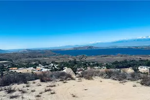
Full Property Details for 650 Mapes Rd
General
- Sold For: $450,000
- Status: Closed
- Type: Lots/Land
- Source: MRMLS
- MLS ID: IV25203983
- Added to Site: 176 day(s) ago
Location
- Area: 232 - Gavilan Hills
- County: Riverside
- Development Name: 232 - Gavilan Hills
- Driving Directions: 650 Mapes Road, Perris
- Dist. to Beach: 1 (Miles)
Utilities
- Water: None
- Dist. to Water: 1
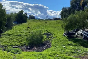
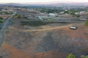
Lot Features
- Property View: None
- Lot Size (Acres): 8.32
- Lot Size (Sq. Ft.): 362,419
- Lot Size Source: Assessor
- Zoning: M2
- Lot Description: Urban
- Fencing (Description): Chain Link
Financial Considerations
Listed and Sold by Nest Real Estate, GABRIELA HANSON